
 Kontakt
 Jak nakupovat

Doručení
Nákupní rádce
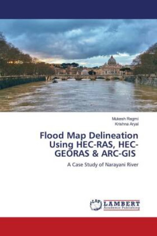
Flood Map Delineation Using HEC-RAS, HEC-GEORAS & ARC-GIS
 Angličtina
 81 b
Až 30 dní na vrácení zboží
Zákazníci také koupili







 /
 Brožovaná
 732
Kč

 /
Brožovaná
613
Kč

This book is based on the one dimensional hydrodynamic model simulation of flood map of one of the largest river basin i.e. Narayani River floodplain, located in the Central zone of Nepal. The study area covers around twenty kilometers of the flood area located at the upper stream of the bridge section in East West Highway of Narayani River. The precipitation data collected from the Department of Hydrology has been used to calculate the four scenario (100, 200, 500 and 1000 years) flood analysis from Gumbell method. The digital model is developed through ARCGIS by feeding the Gumbell analyzed flood data using flood depth as a hydraulic characteristic factor of flood. The hydrodynamic model for mapping were developed using the Hydrologic Engineering Center River Analysis System (HEC-RAS) in concert with HEC-GeoRAS. HEC- GeoRAS set procedures, tools, and utilities for processing Geographic Information Systems data by using a graphical user interface on a GIS platform. Different Flood Map zone has been prepared and the inundation area has been identified in this book as per the discharge taken for four scenario (100, 200, 500 and 1000 years).


Informace o knize
Angličtina
Kategorie

Darujte tuto knihu ještě dnes
Je to snadné
1 Přidejte knihu do košíku a zvolte doručit jako dárek 2 Obratem vám zašleme poukaz 3 Kniha dorazí na adresu obdarovanéhoMohlo by vás také zajímat
 /
Brožovaná
1 861
Kč
 /
Brožovaná
711
Kč

Ahoj! Jsem Libroamiko, tvůj knižní rádce.
Jak ti můžu pomoct?